Land South Of Appleford Road, Appleford Road OX14
2.2 acres (0.898 hectares)
AN OPPORTUNITY TO ACQUIRE A RESIDENTIAL DEVELOPMENT SITE WITH A PENDING PLANNING PERMISSION FOR 17 DWELLINGS ON THE EDGE OF THE POPULAR VILLAGE OF SUTTON COURTENAY, OXFORDSHIRE
LOCATION
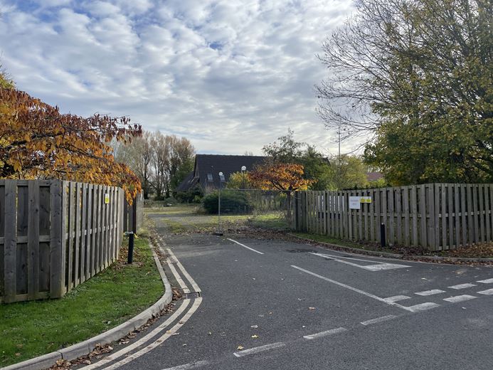
The property is situated to the north eastern edge of Sutton Courtenay, a popular village within the Vale of White Horse district of Oxfordshire. Access to the property is via Skylark Fields road off of the Appleford Road.
Sutton Courtenay is an attractive Oxfordshire village lying on the south bank of the River Thames and is located approximately 2-miles south of Abingdon-on-Thames and approximately 3-miles northwest of Didcot. Facilities within Sutton Courtenay include Burgrey Stores and Post Office, Costcutter, Sutton
Courtenay Village Hall as well as a recreation ground.
Sutton Courtenay also lies directly north of Milton Park, one of the leading and expanding science & technology hubs in the UK hosting over 250 companies and employing over 9,000 people. Abingdon and Didcot provide for a wider range of amenities including a number of primary and secondary schools, major supermarkets including Waitrose, Sainsburys, M&S Foodhall, Tesco, ALDI, Lidl and Iceland. Oxford, located approximately 8-miles north, is a regional city hub providing an extensive range of services and facilities including shops, schools, restaurants, banks, sports centre, retail parks and supermarkets.
THE PROPERTY
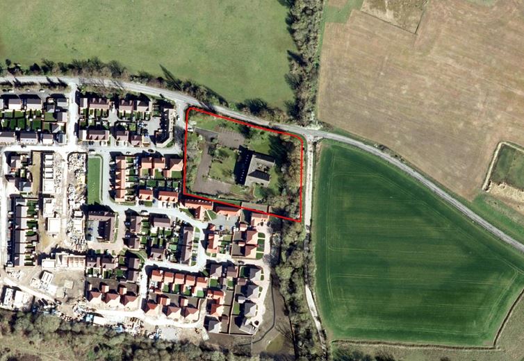
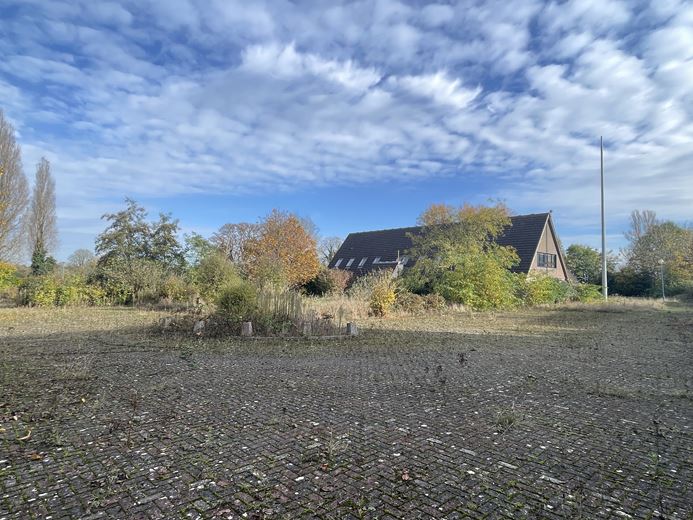
The property extends to approximately 2.22 acres (0.90 hectares) comprising of a now vacant building, previously used for office space, complete with parking and surrounding grassed areas and several mature trees. The property is bounded to the north by Appleford Road, to the east by Loverose Way and Skylark Fields road to the west, from which access to the property is provided. Positioned to the south and west of the property is a recently built out residential development scheme.
The topography of the property is broadly level.
PLANNING AND PROPOSED DEVELOPMENT
The Local Planning Authority is the Vale of White Horse District Council.
The District Councils development plan consists of policies set out in the Vale of White Horse District's Local Plan 2031. Vale of White Horse and South
Oxfordshire District Councils are currently working together on a Joint Local Plan 2041.
The property benefits from a planning permission pending for 17 dwellings (reference P23/V2576/O). The planning application seeks to demolish the existing office building to make space for the proposed residential dwellings, as well as provide for associated access, amenity space and parking.
The pending planning permission proposes a 35% affordable contribution (6 affordable dwellings). The proposed housing mix is a follows:
9 x 2 Bed Houses
4 x 3 Bed Houses
4 x 4 Bed Houses
REGISTERED TITLE
The land is registered with the Land Registry under Title Number ON129354. Please note that the existing title plan is dated and includes land now excluded from this title.
FURTHER INFORMATION
An information pack has been prepared to accompany these particulars and includes all relevant planning, technical and legal information, as well as bidding guidance.
METHOD OF SALE
The opportunity is offered for sale freehold with vacant possession by private treaty with unconditional offers sought.
VIEWING
The property may be viewed from the highway. Parties wishing to walk the site should arrange an appointment with Carter Jonas.
- Type
- Development And Land
- Size of land
- 2.2 acres (0.898 hectares)
- Carter Jonas reference
- 20017275
- Property agent
- Edward Walter
Suggested properties
Here are a few properties you might like, but within 2 extra miles of your current search


